to shopping cart
to cart for brochures

Walking routes

Walking routes in Tyrol

Relax on leisurely walks in Pitztal

Walking routes in Pitztal are defined as short, hardly demanding routes. Some of our hiking paths are suitable for prams. Walking routes are particularly popular with senior citizens and families with small children. Or you may just wish to go on a romantic stroll to stretch your legs after a delicious dinner.

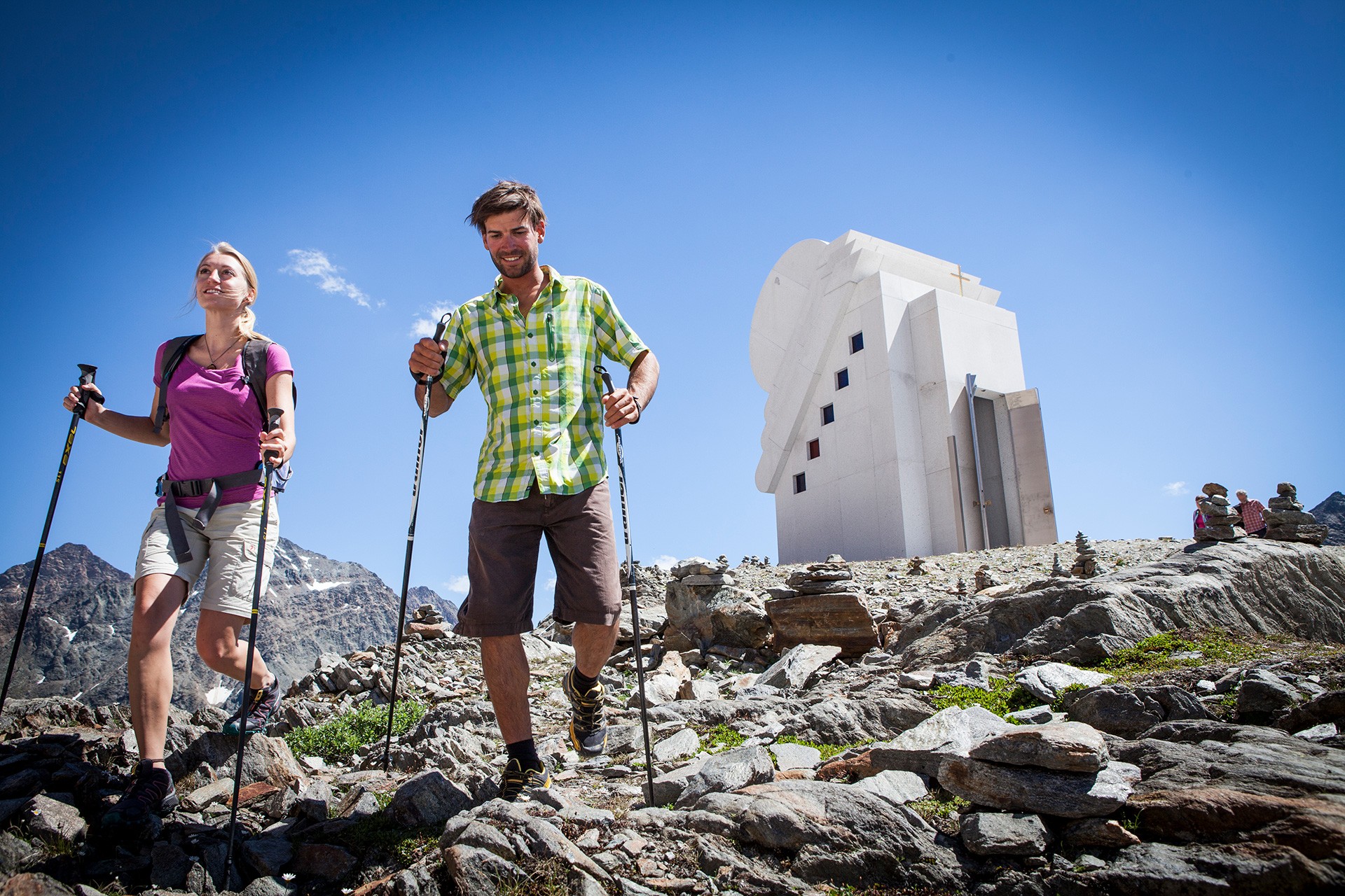
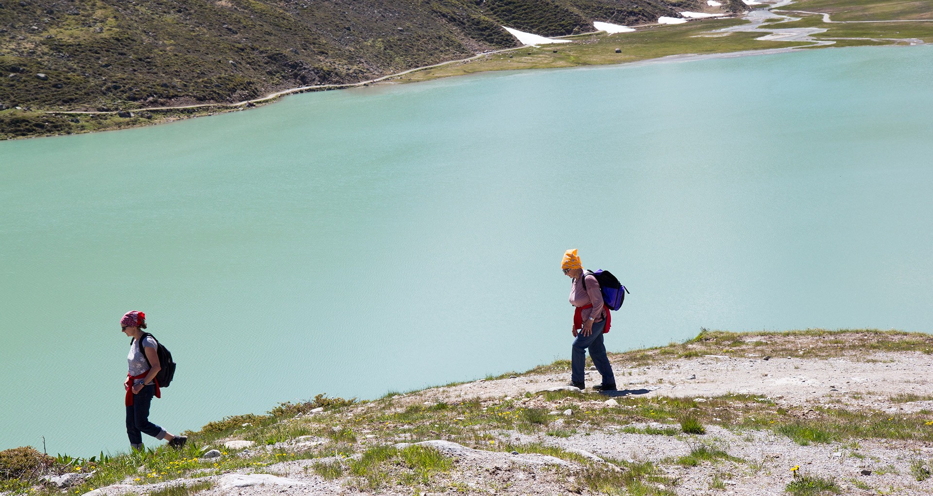
Pitztal does not only offer walking routes down in the valley but also easy routes on higher ground that can easily be accessed by using a mountain railway. You may, for example wish to go on the ZirbenPark circular route using Hochzeiger Bergbahnen, on the Lake Rifflsee circular route using Rifflsee Bergbahnen or walk to the Chapel of White Light on Pitztal Glacier.

Regions:
Whole Pitztal
Hochzeiger
Gletscher
Rifflsee

Walking in Pitztal

What nicer thing to do than going on a short walk in beautiful surroundings with your loved ones?

The hiking trails in Pitztal are especially popular with families with small children and senior citizens. The majority of our paths are suitable for prams and some are even wheelchair-accessible.

Top walking paths in our villages…

Arzl: Diemersteig, Osterstein circular route (small)
Wenns: Klausboden circular route, Piller Moor trail
Jerzens: ZirbenPark circular route, Village hike through Wiesen/processional route
St Leonhard: Gletscherstube, Lake Rifflsee circular route

Sitebuilder 
ZirbenPark circular route
View of the Pillermoor in the Kaunergrat Nature Park
chapel of white light
circular route Rifflsee for the whole fami

Walking to the Chapel of the White Light

Ausgangspunkt
Bergstation Gletscherexpress (2839m)
Endpunkt
Bergstation Gletscherexpress (2841m)

Meadow circular route

Ausgangspunkt
Tourist information office Jerzens (1117m)
Endpunkt
Tourist information office Jerzens (1118m)
Start your hike at the tourist information office in Jerzens and walk approximately 50 metres in the direction of Leins. Then follow the sign “Wiesenrundweg” [meadow circular route] all the way to the MPreis mini supermarket. To return to your staring point follow the road for the final 50 metres. 

Consciousness path

Ausgangspunkt
Parkplatz Volksschule Wald (886m)
Endpunkt
Parkplatz Volksschule Wald (886m)
Starting from the car park next to the Wald primary school (Volksschule Wald), walk directly past the small fire station in the direction of Benni Raich Bridge. At a prominent fork follow the signposting over beautiful meadows, past the through road and houses back to the crossroads and return via the same path to the starting point at the car park near the primary school in Wald. 

Piller Moor nature trail – wheelchair-accessible route

Ausgangspunkt
Car park at the entrance to Piller Moor (1526m)
Endpunkt
Car park at the entrance to Piller Moor (1526m)
It is approximately 500 metres on a gravel path to the turf house square [Torfhüttenplatz] where the path forks off. Turn left to get to Piller Moor natural landmark and the moor observation tower or turn right to walk past the winter feeding station and a path that leads to the peat cutting area. After approximately 200 metres you will reach a platform, which reveals a view of the “Putzenmoos” that is well worth seeing. Here, peat was still cut until the early 1970s. The wheel-chair accessible path then continues for approximately 300 metres until you reach the moor. From there, the road is no longer suitable for wheelchair users.  

Small village walk/processional route

Ausgangspunkt
Centre of Jerzens/Mini MPreis (1117m)
Endpunkt
Centre of Jerzens/Mini MPreis (1117m)
Starting point: for this walk is the village centre of Jerzens. It is a circular route with panoramic views of Jerzen’s parish church. The path continues past the small MPreis supermarket in the direction of Jagerhof. The end of the walk is the church car park. Enjoy this path leading through flowering meadows.

Circular Route ZirbenPark

Ausgangspunkt
Mittelstation (2024m)
Endpunkt
Mittelstation (2024m)
The Swiss pine, also affectionately known as the “Queen of the Alps” is a high-alpine tree. Embark on a journey in our new ZirbenPark at the intermediate station of Hochzeiger. Find out about all facets of this precious type of wood on this special circular walk. The new approx. 1 km long ZirbenPark adventure trail starts at the intermediate station, continues towards  Zollberg leading through a Swiss pine forest, past the Tanzalm hut and then back to the intermediate station. ZirbenPark’s highlight is the cone-shaped ZirbenZapfen adventure tower: this 12 m tall adventure tower features a viewing platform and a 16 m long tube slide. You can easily and conveniently get to the new ZirbenPark by gondola lift. The Zeiger restaurant at the intermediate station invites for a comfortable stop.
 

Landschaftsteich Piller circular route

Ausgangspunkt
Landschaftsteich Piller car park (1361m)
Endpunkt
Landschaftsteich Piller car park (1363m)
Walk through the hamlet of Fuchsmoos for approx. 100 m up towards the Hairer fishpond always keeping to the right. Once there, continue to walk via Oberpiller down to the Piller road and return to your starting point by keeping to the right once again.

Rifflsee circular route

Ausgangspunkt
Rifflsee gondola bottom station (2288m)
Endpunkt
Rifflsee gondola bottom station (2289m)
Take the Rifflsee gondola to the top then walk by the Rifflsee circular route [Rundwanderweg Rifflsee]. This trail is especially suitable for families (including prams) and for the elderly.

Nachtrunde

Ausgangspunkt
Parkplatz Volksschule Wald (886m)
Endpunkt
Parkplatz Volksschule Wald (889m)
Starting point of this hike is the car park at Wald primary school (Volksschule Wald) and as the name of this hike suggests the route has street lighting all through the night and is therefore perfect for an evening or early morning walk. At the start walk past the church and the residential houses until you reach a flat, tarmacked road that connects the two hamlets Mairhof and Mauri. At the end of this road, turn off to the left and return via a through road to the starting point. Another plus of this walk is that it’s on a pavement most of the time. 

Piller circular route

Ausgangspunkt
Car park Piller Zentrum (1353m)
Endpunkt
Car park Piller Zentrum (1349m)
Walk in the direction of Galfunalm to the left of the fire station. Above the sports grounds always turn right at the crossroads to eventually return to your starting point below the sports grounds.
Region: Hochzeiger

Walking routes Hochzeiger

Nature experience

The whole family can easily and comfortably get from Hochzeiger valley station at 1,450 metres to the intermediate station at 2,000 metres above sea level via gondola. This is the ideal starting point for family hikes at Hochzeiger or a walk on our ZirbenPark nature trail. Those who wish to aim even higher can continue their way up via the Sechzeiger double chair lift up to 2,370 metres. From there, it is only a short walk to the Sechzeiger summit cross and its impressive 360 panorama.

Sitebuilder 

Easy hiking tips at Hochzeiger

ZirbenPark family hike
hiking tour from the gondola top station
Ascent with the gondola to the middle station at 2,000 Meter. This is the starting point for the one kilometer circular path through the ZirbenPark. There is much to discover at the various stations in the ZirbenPark. 
1 h walking time, easy hiking tour


short hike from the Sechszeiger lift top station
(A) *

Ascent with the gondola and double chair lift Sechszeiger, short walk to the Sechszeiger Mountain cross at 2,395 m, back to the Sechszeiger lake, breathtaking panorama view, 10 min walking time, easy hiking tour

* look up in the Hochzeiger hiking tips brochure

Region: Gletscher

Short Hiking Tours at the Pitztal Glacier

Scenic Loop Walk at Pitzal Glacier

Planning an easy walking tour you probably won't think about a glacier region. Thanks to the top modern mountain lifts at Pitztal Glacier you can explore the high Alpine regions on a lovely mountain walk almost effortlessly.

Sitebuilder 

Recommended short walking tours at Pitztal Glacier

Starting point: Gletscherexpresstop station at 2.840 m

  • Chapel Trail to the "Chapel of White Light" 
    Walking time: 15-20 min
    Difficulty level: light blue
     
  • Trail to Glacier Snout – NEW from summer 2017
    Walking time: 1 – 2 hours (both ways)
    Difficulty level: light blue
     
  • Trail to Cafe 3440 – NEW from summer 2017
    Walking time: 15-20 min
    Difficulty level: light blue
     
  • Mittelbergferner Hike – NEW from summer 2017
    Walking time: 1-1.5 hours
    Difficulty level: blue 
Hiking Tour towards the Chapel of White Light
Region: Rifflsee

Short Hiking Tours in the Rifflsee Area

Nature at its best at Tirol's Rifflsee

The mountain gondola ride up to Rifflsee promises uninterrupted views of the nearby mountain ranges and the Pitztal Alps.
A great choice of leisurely walking trails and hiking paths suitable for all the family is waiting for you at the Rifflseebahn top station.
 

Sitebuilder 

Walking Trails, Nordic Walking Paths and Trail Running Routes at Rifflsee

Start: Rifflseebahn (gondola) top station - Restaurant Sunna Alm 2,291 m

  • Rifflsee Loop Walk: around the scenic lake
    Distance: 3.7 km  Walking time: 40-60 min
    Difficulty level: none
     
  • Rifflsee Hut Round Tour: walking trail to Rifflseehütte
    Distance: 1 km  Walking time: 15-20 min
    Difficulty level: none
     
  • Sunna Alm–Muttenkopf  Hike: walking trail to Muttenkopf
    Distance: 1.5 km  Walking time: 20-30 min
    Difficulty level: none
Hiking around Rifflsee Lake
Information

Webcams

Information

Weather

Information

0 - 350cm

Information

7 open lifts

Information

13 open slopes

Öffungszeiten

Now open

Angebot suchen

Search for offers