Hike through a nature park, to a catered mountain hut or take a short turn in the ski resort: discover the winter hiking highlights of Pitztal and experience the tranquillity and peace of your snowy, natural surroundings.
to shopping cart
to cart for brochures
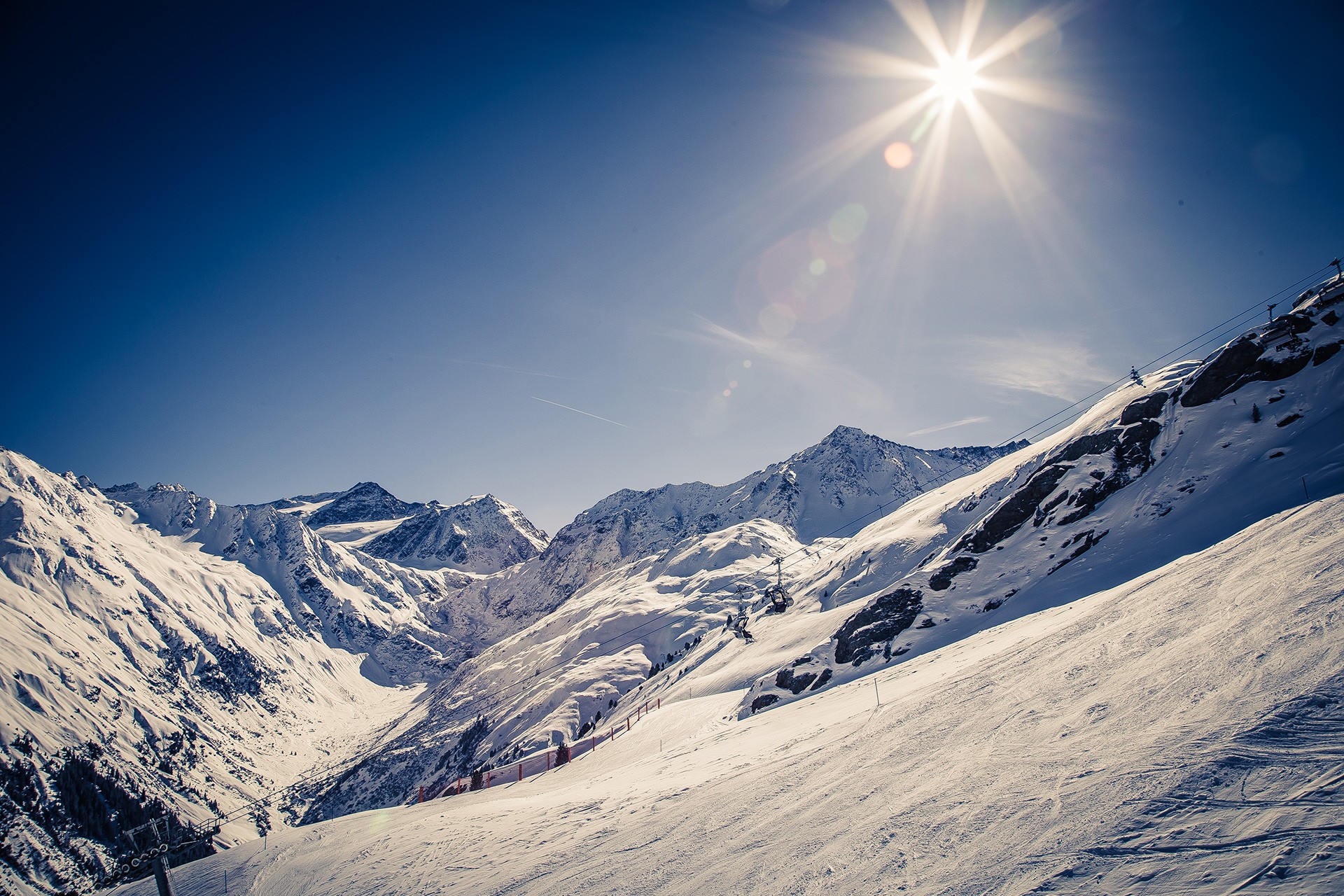
Winter hiking in Pitztal

Winter hiking in Pitztal
Enjoy unspoilt Tyrolean winter scenes
Regions:
Whole Pitztal
Hochzeiger
Gletscher
Rifflsee
Winter hiking Pitztal
Winter hiking in Kaunergrat Nature Park - Pitztal
There are several marked winter hiking routes to be discovered at Kaunergrat Nature in Pitztal. Enjoy the landscape covered in deep snow and take in the panoramic views with tall and mighty peaks all around. The beautiful Harber pond circular route can be started straight from the car park of the Nature Park Centre. Here, the thrilling viewing platform, Gacher Blick invites guests to discover impressive insights into the region’s natural and cultural history. This makes for a perfect starting or end point of your winter hike!
Winter hiking to a catered mountain hut
The alpine pastures of the catered mountain hut Gogles Alm offer breath-taking scenery in winter too! Take in the wonderful panoramic views of the surrounding snowy mountain scenery from the hut’s terrace. Gogles Alm is open and awaits with regional delicacies on Fridays, Saturdays and Sundays during the winter months. Enjoy your well-earned reward after an ascent of 500 metres to this mountain hut!
Sitebuilder


Hiking in the snow

Winter hiking at Hochzeiger

Snow hikes along the cross-country ski trail in St. Leonhard
Snow hikes along a cross-country ski trail
Winter hikes can come into their own on a 21 kilometre long cross-country ski trail along the valley connecting Mittelberg to Wiese in St Leonhard. Experience the enchanting atmosphere of this authentic winter adventure hiking through snow-covered meadows, forests and roof-tops. You can access this winter hiking trail at every hamlet along the municipality of St Leonhard.
Go on a wonderful circular hiking route in the ski resort
A walk on the Zirben trail is an ideal alternative to skiing at Hochzeiger ski resort. The starting point of this 700 metre long winter hiking route is Zeigerrestaurant at Hochzeiger intermediate station. In winter you can also take a walk from there to the Stalderhütte or Hochzeigerhaus (hiking time ca. 30 – 40 minutes, approximately 1.5 kilometres).
On Pitztal Glacier you can take a short, ca. 10 minute walk to the Chapel of the White Light from the top station of the Glacier Express.
A circular walk around the snowy Lake Rifflsee is perfect at Rifflsee ski resort.
Switch off and unwind on one of Pitztal’s many other winter hikes.
Here in the interactive map you can find our winter hiking routes. Also in our folder Winter Hiking - Cross Country Skiing - Piste Tours you will find detailed winter hiking routes.
Categories
Difficulty
Distance
Duration
Altitude
Mandarfen - Pitztaler Schihütte
Ausgangspunkt
Bus stop Mandarfen (1675m)
Endpunkt
Bus stop Mandarfen (1674m)
Starting from the bus stop Mandarfen-Rifflseebahn walk past the Rifflsee gondola valley station and cross the bridge. After the bridge turn left, follow the cross-country trail towards to Mittelberg, after a certain section along the edge of the slope towards you hike the Pitztaler Schihütte. After taking a break for refreshments return via the same route to your starting point.
Eggenstall - Enger circular route
Ausgangspunkt
Busstop St. Leonhard i. P. Gh Sonne (1341m)
Endpunkt
Busstop St. Leonhard i. P. Gh Sonne/Liesele (1341m)
Starting point is St. Leonhard i. P. Gh Sonne/Liesele bus stop in Eggenstall. Cross the bridge and turn right to follow the winter hiking trail to Innerwald. Once there, follow the trail to Außerwald before crossing a bridge once again. Then turn right in the direction of Hotel Alpenhof before turning left into a moderately steep in the direction of Bichl. Walk past the partially frozen Bichl waterfall and follow the trail along the edge of the forest back to Eggenstall. The Hotel Alpenhof along the way invite for a cozy stop.
Winterwanderweg am Gachenblick
Ausgangspunkt
Nature Park Centre Kaunergrat at Gachenblick (1575m)
Endpunkt
Nature Park Centre Kaunergrat at Gachenblick (1575m)
Osterstein tour (big)
Ausgangspunkt
Car park Arzl football field (863m)
Endpunkt
Car park Arzl football field (863m)
The circular hiking trail around the Osterstein starts from the Arzl football field. Follow the farm and forest road to the left of the football field. At the junction follow the road uphill in the direction of Ostersteinsiedlung for about 400 m. Then return viathe "Diemersteig" path back to the starting point. Tip: If you turn off the Diemersteig path in the direction of Arzl, you can reach the village's centre after a few minutes and there are two opportunities to take a break (Restaurant Herz As and Pizzeria Die Post).
Circular route Mandarfen - Tieflehn
Ausgangspunkt
Bus stop Mandarfen (1679m)
Endpunkt
Bus stop Mandarfen (1678m)
The winter hike starts at the Mandarfen-Rifflseebahn bus stop. From there, hike past the Rifflsee gondola valley station and cross the bridge. Then turn right and walk along the winter hiking trail to the next bridge. Then follow the groomed winter hiking trail in the direction of Tieflehn and from there, continue in the direction of Plangeross. Just before reaching the hamlet Plangeross, cross the main road and follow the trail on the right back to Tieflehn. There are several opportunities to take a break along this route before returning to the starting point: Siglu bar at Hotel Vier Jahreszeiten, Mittagskogel Lounge, Pitztaler Alm, Hotel Zirbenhof and Schwalbennest bar at Hotel Wildspitze.
Benni-Raich-Bridge - Wald
Ausgangspunkt
Car park Bungy Stüberl 1 (820m)
Endpunkt
Car park Bungy Stüberl 1 (820m)
From the Bungy Stüberl (not catered in winter) car park 1 walk uphill to admire the gigantic structure of the new suspension bridge with a span of 137.7 m. Take a walk 94 m above the ground across the ca. 1.5 m wide bridge to the hamlet of Wald. Return via bus or via the same route. (20 minutes' walking time one way).
Old road - Steinhof - Langenau - Wenns
Ausgangspunkt
Bus stop Wenns Pitztaler Hof or Wenns Gemeindezentrum (civic centre) (1012m)
Endpunkt
Bus stop Wenns Pitztaler Hof or Wenns Gemeindezentrum (civic centre) (1015m)
Starting point is the bus stop Wenns Pitztalerhof or Wenns Gemeindezentrum (Civic Centre). You can reach the starting point either by Regiobus Pitztal or it's a 5 minute walk from the carpark of the church/churchhall. At the junction follow the road in the direction of the village towards the hamlet of Klöfles. From there hike along hte forest road or winter hiking trail in the direction of Steinhof. Continue to hike past the Langenau hamlet back to your starting point in Wenns. There are several pubs and restaurants that invite to take a break at the village centre (Gastof Pitztalerhof, Gasthof Alte Post and Rutsche Bark Pub).
Pitzenhöfe circular route
Ausgangspunkt
Bus stop Wenns Pitztaler Hof or Wenns Gemeindezentrum (civic centre) (1003m)
Endpunkt
Bus stop Wenns Pitztaler Hof or Wenns Gemeindezentrum (civic centre) (1003m)
Start your hike from the bus stop Pitztaler Hof through the historic lower town with its museum, the historic, beautifully painted ‘Platzhaus’, war memorial and parish church and follow the signpost ‘Rundwanderweg Pitzenhöfe’ [Pitzenhöfe circular route]. Opposite the restaurant "alte Post", turn right and immediately left and follow the path until the Pitzenhöfe hamlet. Turn right before the wooden bridge and follow the forest path to the St. Margarethen hamlet (Wenns). Continue to walk on the pavement of the main road to return to your starting point. There are several options to stop for refreshments on your way back (Pitz Park, Gasthof Pitztalerhof, Gasthof Alte Post and Rutsche Pub Bar).
Old road to Arzl
Ausgangspunkt
Bus stop Wenns Pitztaler Hof or Wenns Gemeindezentrum (civic centre) (999m)
Endpunkt
Turn-off Timls (927m)
Starting point is the bus stop Wenns Pitztalerhof or Wenns Gemeindezentrum. With the Regio Bus Pitztal or within 5 minutes walking from the parking space Mehrzwecksaal you will reach the starting point. Follow the turn-off in the direction Siedlung towards Klöfles. There you take the forest path or rather winter hiking path towards Arzl. Once there you can either comfortably return to the starting point on the Pitztal Regiobus or return by the same route. Walking time from Wenns to the Timls turnoff is approx. 1.2 hrs
Hike from Falsterwies to Gischlewies
Ausgangspunkt
bus stop Jerzens Hotel Jerzner Hof (1180m)
Endpunkt
bus stop Jerzens Hotel Jerzner Hof (1180m)
The trail sets off at Hotel Jerzner Hof bus stop and leads uphill to the hamlet of Falsterwies. Once there, continue on a wide forest road to the hamlet of Gischlewies. Return to the starting point via the same route. There are several options for a pub stop only a few minutes' walk from the starting and end point of this hike (Pitzloch, Restaurant Zirm and Hotel zum Lammwirt).
Region:
Hochzeiger
Winter Hiking Hochzeiger
Pine trail: circular winter walk
Winter hiking at Hochzeiger in Pitztal is closely connected to the pine. The pine, also known as the “Queen of the Alps”, is a high-alpine tree. It is said to promote well-being and have harmonizing properties. Some pine trees can be up to 700 years old. There are very beautiful pine forests at Hochzeiger in Pitztal.
The pine trail circular winter hike leads trough a beautiful pine forest with views of the sun-kissed ski slopes at Hochzeiger. The starting point of this winter hike is the Zeigerrestaurant at the intermediate station. The winter hike (approximately 700 m long) follows a path in the direction of Zollberg through a pine forest and ends at the Zeigerrestaurant at the intermediate station. You can enjoy the impressive panoramic views from the viewing platform of the twelve metre high pine cone adventure tower. Single trip tickets are available for winter hikers and walkers at the gondola ticket office. The Zeigerrestaurant is particularly inviting.
Sitebuilder
For all winter hikers there is a special offer at Hochzeiger: The Zirbenweg - the winter hiking round trip at the middle station.
Winter hike from the intermediate station to the bottom station
There is a sun-kissed winter hiking trail with panoramic views that starts at Hochzeiger intermediate station, then on to the mountain huts Tanzalm, and then further on to the Stalderhütte or Hochzeigerhaus. The starting point for this winter hike (with numerous options for a break at the mountain huts) is the mountain station of the gondola at 2,000 metres. It is only a few metres to the Tanzalm and the Hochzeigerhaus or Stadlerhütte are only about 1,500 metres further away. Take a leisurely stroll back to the intermediate station and spare your knees by taking the gondola back down to the bottom station. Or continue to walk to the hamlet of Kaitanger (car park at Hochzeiger mountain railways) from the Hochzeigerhaus or Stadlerhütte. This section of the walk will take approximately an hour.

A winter hike in the Hochzeiger ski area promises great views
Region:
Rifflsee
Rifflsee Winter Walking
A both relaxing and highly romantic winter walking tour in the snow-blanketed Rifflsee area creates memories staying with you forever.
First you take a panoramic mountain gondola ride while indulging in the magnificent mountain world of the Pitztal Alps. On a lovely hiking tour towards the snow-covered Rifflsee mountain lake or Rifflseehütte you inhale the crisp and clean Alpine air, accompanied by uninterrupted vistas of 3,000 m high summits.
The quaint sun terrace of Restaurant Sunna Alm invites sun worshippers to take a rest and restore energy also in winter.
Sitebuilder

Coffee-Break at the Restaurant Sunna Alm Rifflsee

Restaurant Sunna Alm in the Rifflsee Ski Area in Pitztal

Winter Hiking at Rifflsee

Rifflsee Ski Area and Restaurant Sunna Alm
Special Recommendations:
- Winter walking trail towards Rifflsee mountain lake (5 kilometers)
- Rifflseehütte mountain inn and back again (3 kilometers)
Sunna Alm Mountain Lift in the Rifflsee Area
Sharing is fun...


