Hike through a nature park, to a catered mountain hut or take a short turn in the ski resort: discover the winter hiking highlights of Pitztal and experience the tranquillity and peace of your snowy, natural surroundings.
to shopping cart
to cart for brochures
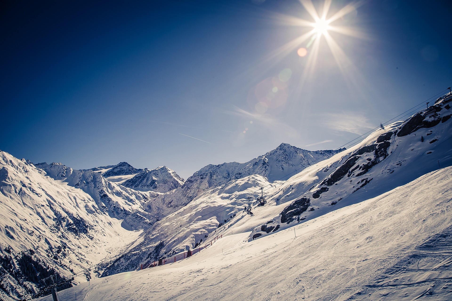
Winter hiking in Pitztal

Winter hiking in Pitztal
Enjoy unspoilt Tyrolean winter scenes
Regions:
Whole Pitztal
Hochzeiger
Gletscher
Rifflsee
Winter hiking Pitztal
Winter hiking in Kaunergrat Nature Park - Pitztal
There are several marked winter hiking routes to be discovered at Kaunergrat Nature in Pitztal. Enjoy the landscape covered in deep snow and take in the panoramic views with tall and mighty peaks all around. The beautiful Harber pond circular route can be started straight from the car park of the Nature Park Centre. Here, the thrilling viewing platform, Gacher Blick invites guests to discover impressive insights into the region’s natural and cultural history. This makes for a perfect starting or end point of your winter hike!
Winter hiking to a catered mountain hut
The alpine pastures of the catered mountain hut Gogles Alm offer breath-taking scenery in winter too! Take in the wonderful panoramic views of the surrounding snowy mountain scenery from the hut’s terrace. Gogles Alm is open and awaits with regional delicacies on Fridays, Saturdays and Sundays during the winter months. Enjoy your well-earned reward after an ascent of 500 metres to this mountain hut!
Sitebuilder


Hiking in the snow

Winter hiking at Hochzeiger

Snow hikes along the cross-country ski trail in St. Leonhard
Snow hikes along a cross-country ski trail
Winter hikes can come into their own on a 21 kilometre long cross-country ski trail along the valley connecting Mittelberg to Wiese in St Leonhard. Experience the enchanting atmosphere of this authentic winter adventure hiking through snow-covered meadows, forests and roof-tops. You can access this winter hiking trail at every hamlet along the municipality of St Leonhard.
Go on a wonderful circular hiking route in the ski resort
A walk on the Zirben trail is an ideal alternative to skiing at Hochzeiger ski resort. The starting point of this 700 metre long winter hiking route is Zeigerrestaurant at Hochzeiger intermediate station. In winter you can also take a walk from there to the Stalderhütte or Hochzeigerhaus (hiking time ca. 30 – 40 minutes, approximately 1.5 kilometres).
On Pitztal Glacier you can take a short, ca. 10 minute walk to the Chapel of the White Light from the top station of the Glacier Express.
A circular walk around the snowy Lake Rifflsee is perfect at Rifflsee ski resort.
Switch off and unwind on one of Pitztal’s many other winter hikes.
Here in the interactive map you can find our winter hiking routes. Also in our folder Winter Hiking - Cross Country Skiing - Piste Tours you will find detailed winter hiking routes.
Categories
Difficulty
Distance
Duration
Altitude
Fishpond - Schön - Jerzens
Ausgangspunkt
Jerzens Fischteich (fishpond) (965m)
Endpunkt
Jerzens Fischteich (fishpond) (965m)
Starting point is the fishpond in Jerzens. Follow the path in the direction of Kienberg until you reach a bridge. At the bridge, the winter hiking trail forks off towards Schönlarch, follow it and continue through the district of Schön (please be careful when crossing the country road). Continue to walk on the forest path all the way to Jerzens (bus stop at the fi re station). Here, you may return via public bus to the fishpond or you may also return via the Niederhof hamlet to the fishpond (an extra 30 min walk).
Walking time: 1 hr to the bus stop at the fire station.
Walking time: 1.5 hrs round trip from/to fishpond
Walking time: 1 hr to the bus stop at the fire station.
Walking time: 1.5 hrs round trip from/to fishpond
Imsterberg
Ausgangspunkt
Car park Steige (855m)
Endpunkt
Car park Steige (855m)
Start at Steige car park and hike uphill toward the farm. Then turn right and follow the trail in the direction of
the sawmill/ toboggan run. Follow the wide forest path through the pine forest which will eventually lead to a narrow steep trail which leads through a romantic gorge until you reach the village of Imsterberg. Here, Gasthaus Venetrast invites to take a break. Hiking time to there is approx. 2 hrs. You can return to the staring point via the same route.
the sawmill/ toboggan run. Follow the wide forest path through the pine forest which will eventually lead to a narrow steep trail which leads through a romantic gorge until you reach the village of Imsterberg. Here, Gasthaus Venetrast invites to take a break. Hiking time to there is approx. 2 hrs. You can return to the staring point via the same route.
fishpond - Ritzenried hamlet
Ausgangspunkt
Bus stop Jerzens Fischteich (964m)
Endpunkt
Bus stop Jerzens Fischteich (957m)
Starting point for this hike is the fishpond in Jerzens. From there, follow the road towards Kienberg until you reach a bridge. At the bridge, the winter hiking trail forks off, follow it towards Schönlarch and then the district of Schön (please be careful when crossing the country road) and follow the valley hiking trail to Ritzenried. Here you may return via public bus to the fishpond or return via the same route. Walking time: 3 hrs (1.5 hrs one way). Fischteich Jerzens at the start is an ideal place to have a break.
Winter hiking piösmes towards Arzler Alm
Ausgangspunkt
Bushaltestelle Piösmes Scheibe (1392m)
Endpunkt
Bushaltestelle Piösmes Scheibe (1392m)
Start at the bus stop Piösmes Scheibe. Once there, walk in the direction of Restaurant zur Einkehr facing into the valley. Then cross the bridge and follow the winter hiking trail on the left into the valley until you reach the fork to Arzler Alm. Then follow the groomed winter hiking trail through the snowy forest. Return to your starting point via the same route. Tip: The return path leads past Restaurant Zur Einkehr which is an ideal place to take a break.
Matzlewald - Jerzens fishpond
Ausgangspunkt
Bus stop Wenns Matzlewald (1138m)
Endpunkt
Bus stop Wenns Matzlewald (1135m)
Walk from the Matzlewald bus stop to the hamlet Matzlewald. Then continue to walk on the forest road to Kienberg. From the hamlet of Kienberg walk downhill to Jerzens fishpond. After a pub stop at Fischteich Jerzens return refreshed to your starting point via the same route.
Fire station – Ritzenried
Ausgangspunkt
Bus stop Jerzens fire station (1098m)
Endpunkt
Bus stop Jerzens fire station (1097m)
Starting point is on the opposite side of the fire station, on the right hand side of the Mühlbach stream. There is an easy ascent at the start of the walk, otherwise there are only minor gradients. At the first fork, follow the path on the right to the hamlet of Schön and then continue to Ritzenried. Follow the same way back to the starting point or take the Regiobus Pitztal. There are several options for a pub stop only a few minutes' walk from the starting or end point of this walk (Pitzloch, Restaurant Zirm and Hotel zum Lammwirt).
Alpine pasture hike Stalderhütte/Hochzeiger Haus
Ausgangspunkt
Kaitanger (1433m)
Endpunkt
Kaitanger (1434m)
Start this hike from the bus stop Jerzens/Kaitanger. Follow the signposts through the forest until you pass the Stadlerhütte or reach the Hochzeigerhaus which is another 5 minutes' walk. After taking some refreshments continue to your starting point via the same route.
Winter hiking path Gogles Alm
Ausgangspunkt
Car park Abzw. Fließ (1505m)
Endpunkt
Gogles Alm (2016m)
From the starting point follow the prepared winter hiking trail up to Gogles Alm. Return either via the same route or cover the distance with the sledge. You don't have to carry the sledge up, you can rent it directly at the Gogles Alm.
Winter hiking path Fischteich Piller - Gogles Alm
Ausgangspunkt
Fischteich Piller (1406m)
Endpunkt
Gogles Alm (2014m)
Follow the prepared winter hiking trail from the Piller fishpond up to the Gogles Alm. Return either via the same route or cover the distance with the sledge. You can rent a toboggan at the Piller fishpond or directly at the Gogles Alm.
Region:
Hochzeiger
Winter Hiking Hochzeiger
Pine trail: circular winter walk
Winter hiking at Hochzeiger in Pitztal is closely connected to the pine. The pine, also known as the “Queen of the Alps”, is a high-alpine tree. It is said to promote well-being and have harmonizing properties. Some pine trees can be up to 700 years old. There are very beautiful pine forests at Hochzeiger in Pitztal.
The pine trail circular winter hike leads trough a beautiful pine forest with views of the sun-kissed ski slopes at Hochzeiger. The starting point of this winter hike is the Zeigerrestaurant at the intermediate station. The winter hike (approximately 700 m long) follows a path in the direction of Zollberg through a pine forest and ends at the Zeigerrestaurant at the intermediate station. You can enjoy the impressive panoramic views from the viewing platform of the twelve metre high pine cone adventure tower. Single trip tickets are available for winter hikers and walkers at the gondola ticket office. The Zeigerrestaurant is particularly inviting.
Sitebuilder
For all winter hikers there is a special offer at Hochzeiger: The Zirbenweg - the winter hiking round trip at the middle station.
Winter hike from the intermediate station to the bottom station
There is a sun-kissed winter hiking trail with panoramic views that starts at Hochzeiger intermediate station, then on to the mountain huts Tanzalm, and then further on to the Stalderhütte or Hochzeigerhaus. The starting point for this winter hike (with numerous options for a break at the mountain huts) is the mountain station of the gondola at 2,000 metres. It is only a few metres to the Tanzalm and the Hochzeigerhaus or Stadlerhütte are only about 1,500 metres further away. Take a leisurely stroll back to the intermediate station and spare your knees by taking the gondola back down to the bottom station. Or continue to walk to the hamlet of Kaitanger (car park at Hochzeiger mountain railways) from the Hochzeigerhaus or Stadlerhütte. This section of the walk will take approximately an hour.

A winter hike in the Hochzeiger ski area promises great views
Region:
Rifflsee
Rifflsee Winter Walking
A both relaxing and highly romantic winter walking tour in the snow-blanketed Rifflsee area creates memories staying with you forever.
First you take a panoramic mountain gondola ride while indulging in the magnificent mountain world of the Pitztal Alps. On a lovely hiking tour towards the snow-covered Rifflsee mountain lake or Rifflseehütte you inhale the crisp and clean Alpine air, accompanied by uninterrupted vistas of 3,000 m high summits.
The quaint sun terrace of Restaurant Sunna Alm invites sun worshippers to take a rest and restore energy also in winter.
Sitebuilder

Coffee-Break at the Restaurant Sunna Alm Rifflsee

Restaurant Sunna Alm in the Rifflsee Ski Area in Pitztal

Winter Hiking at Rifflsee

Rifflsee Ski Area and Restaurant Sunna Alm
Special Recommendations:
- Winter walking trail towards Rifflsee mountain lake (5 kilometers)
- Rifflseehütte mountain inn and back again (3 kilometers)
Sunna Alm Mountain Lift in the Rifflsee Area
Sharing is fun...


