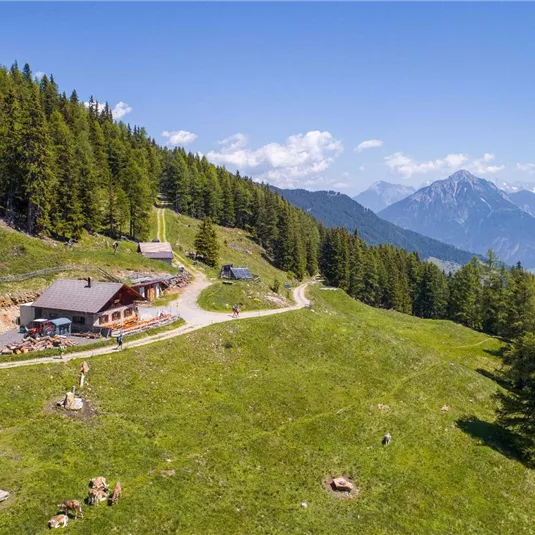
E5 Zams - Glanderspitze - Wenns

Long distance trails

Medium

19,26 km

11:30 h

1807 m

1572 m

2508 m

Description

The starting point is the valley station of the Venetbahn in Zams. From there, the long-distance hiking trail follows the Wiesensteig (Trail 2a) uphill to the Zammer Alm and the Zams Ski Hut. Both offer places to stop for refreshments...

Features & Characteristics

Best Season

Jan

Feb

Mar

Apr

May

Jun

Jul

Aug

Sep

Oct

Nov

Dec

Starting Point:

bottom station Venetbahn in Zams

End Point:

centre of Wenns

Multi-Day Tour Feature

Variante
Map & Elevation Profile

Refreshments & infrastructure

Gogles Alm
Gogles Alm (2.017m)

Alpine pasture

Mountain hut

Fließ

Today

09:00 AM - 10:00 PM

Tomorrow

09:00 AM - 10:00 PM

Monday

09:00 AM - 10:00 PM

Tuesday

09:00 AM - 10:00 PM

Wednesday

09:00 AM - 10:00 PM

Thursday

09:00 AM - 10:00 PM

Friday

09:00 AM - 10:00 PM

Larcher Alm
Larcher Alm (1,814 m)

Alpine pasture

Mountain hut

Wenns

Closed

Similar Tours

IMG-20210820-WA0027.jpg

Medium

E5 option: Zams - Braunschweiger Hütte

Medium

Long distance trails

16,70 km

1452 m

1629 m

2755 m

Wenns Sommer Ort

Easy

E5 Alternative route valley hiking trail: Wenns – Scheibe

Easy

Long distance trails

18,30 km

700 m

300 m

1382 m

Galflunalm

Hard