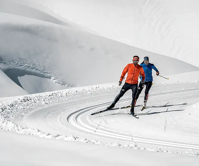
to shopping cart
to cart for brochures

Winter hiking in Pitztal

Winter hiking in Pitztal

Enjoy unspoilt Tyrolean winter scenes

Hike through a nature park, to a catered mountain hut or take a short turn in the ski resort: discover the winter hiking highlights of Pitztal and experience the tranquillity and peace of your snowy, natural surroundings.

Regions:
Whole Pitztal
Hochzeiger
Gletscher
Rifflsee

Winter hiking Pitztal

Winter hiking in Kaunergrat Nature Park - Pitztal

There are several marked winter hiking routes to be discovered at Kaunergrat Nature in Pitztal. Enjoy the landscape covered in deep snow and take in the panoramic views with tall and mighty peaks all around. The beautiful Harber pond circular route can be started straight from the car park of the Nature Park Centre. Here, the thrilling viewing platform, Gacher Blick invites guests to discover impressive insights into the region’s natural and cultural history. This makes for a perfect starting or end point of your winter hike!

Winter hiking to a catered mountain hut

The alpine pastures of the catered mountain hut Gogles Alm offer breath-taking scenery in winter too! Take in the wonderful panoramic views of the surrounding snowy mountain scenery from the hut’s terrace. Gogles Alm is open and awaits with regional delicacies on Fridays, Saturdays and Sundays during the winter months. Enjoy your well-earned reward after an ascent of 500 metres to this mountain hut!    

Sitebuilder 
Hiking in the snow
Hiking in the snow
Winter hiking at Hochzeiger
Snow hikes along the cross-country ski trail in St. Leonhard

Snow hikes along a cross-country ski trail

Winter hikes can come into their own on a 21 kilometre long cross-country ski trail along the valley connecting Mittelberg to Wiese in St Leonhard. Experience the enchanting atmosphere of this authentic winter adventure hiking through snow-covered meadows, forests  and roof-tops. You can access this winter hiking trail at every hamlet along the municipality of St Leonhard.

Go on a wonderful circular hiking route in the ski resort

A walk on the Zirben trail is an ideal alternative to skiing at Hochzeiger ski resort. The starting point of this 700 metre long winter hiking route is Zeigerrestaurant at Hochzeiger intermediate station. In winter you can also take a walk from there to the Stalderhütte or Hochzeigerhaus (hiking time ca. 30 – 40 minutes, approximately 1.5 kilometres).

On Pitztal Glacier you can take a short, ca. 10 minute walk to the Chapel of the White Light from the top station of the Glacier Express.

A circular walk around the snowy Lake Rifflsee is perfect at Rifflsee ski resort.

Switch off and unwind on one of Pitztal’s many other winter hikes.

Here in the interactive map you can find our winter hiking routes. Also in our folder Winter Hiking - Cross Country Skiing - Piste Tours you will find detailed winter hiking routes.

Categories

Difficulty

Distance

Distance ranges from 0km to 21km

Duration

Duration ranges from 0h to 4h

Altitude

Altitude ranges from 0m to 665m

Winter hike intermediate station - Hochzeiger Haus/Stadlerhütte - Kaitanger

Ausgangspunkt
Zeigerrestaurant (2024m)
Endpunkt
Kaitanger (1434m)
Starting point for the 5.3 km winter hiking route is the Zeigerrestaurant at the intermediate station on 2,000 m.  You can reach the Hochzeiger Haus/Stalderhütte at 1,840 m within 30 minutes. Continuethe road downhill for ca. 4 km to the hamlet Kaitanger (approx. 1 hr).

Liss - centre of Jerzens

Ausgangspunkt
Car park Liss/Hochzeiger Bergbahnen (mountain railways) (1462m)
Endpunkt
centre of Jerzens (1122m)
Starting at the hamlet of Liss follow the signs downhill to the village centre of Jerzens. This walk leads through the hamlets of Larchwies, Haag, Breitwies and Oberfeld to the village centre. Once there, several pubs and restaurants invite to take a break (Pitzloch, Restaurant Zirm and Hotel zum Lammwirt).

Nachtrunde Stillebach

Ausgangspunkt
Biohotel Stillebach (1410m)
Endpunkt
Biohotel Stillebach (1412m)
Winter hiking pleasure at night. The 1 km long circular route starts and ends at the Biohotel Stillebach, which invites for a cozy stop.

Kitzgartenschlucht gorge

Ausgangspunkt
Bus stop Zaunhof Hairlach (1279m)
Endpunkt
Bus stop Zaunhof Wiese (1180m)
Setting out from the bus stop, walk out of the valley until you reach a bridge. Before the bridge follow the groomed winter hiking trail on the right. This will take you along the Pitze river through the wild and romantic Kitzgarten gorge until you reach the hamlet Wiese. To return, follow the same route or, for ease, use the shuttle bus to return to your starting point. To shorten your wait for the bus, stop for a coffee at Hotel Gasthof Wiese. 

Circular route Stillebach

Ausgangspunkt
Bus stop Stillebach (1409m)
Endpunkt
Bus stop Stillebach (1409m)
Starting point is the bus stop in Stillebach. Cross the bridge next to the barn. Then turn left and walk along the groomed winter hiking trail until you reach the next bridge. After crossing the bridge, continue to walk on the right towards the hamlet Weixmannstall, past the chapel and the frozen lake to the hamlet Stillebach. From the hotel Biohotel Stillebach you return via the tarmac road to your starting point. The hotel's restaurant Grünzeug is an inviting opportunity to have a break.

Winterhiking path to the Chapel of White Lights

Ausgangspunkt
Top station Gletscherexpress (2839m)
Endpunkt
Top station Gletscherexpress (2841m)
The famous Tyrolean artist, Professor Rudi Wach, created his “Chapel of the White Light” at apoint just a few minutes’ walk from the glacier restaurant “Kristall”. The Kapellenweg leads off the ski slope to the chapel and invites you to relax. A crystal of white granite, breaking out from deep inside the earth joining the light of the sky. The altar carved out of a single piece of granite is part of this great crystal. It forms the inner core of the crystal. At the same time it combines the elements of earth and light. 33 people can gather around it. It embodies spiritual communication. It becomes the centre. The incoming sunlight is refracted by coloured windows, producing a joyful feeling of harmony and welcome security, causing a dialogue to take place between the physical and the spiritual, between the inner and outer world of people. Tip: Take the Wildspitzbahn gondola up to Café 3440, where you can enjoy the panoramic views of the Wildspitze, the highest peak of Northern Tyrol while enjoying a delicious piece of cake. For even greater views to marvel at walk up to the viewing platform, just a few paces from Café 3440.


Around the Breite

Ausgangspunkt
Car park Steige (855m)
Endpunkt
Car park Steige (856m)
Walk from the Car park Steige up to the farm and right head out towards the sawmill/ toboggan run. When you come to the fork follow the trail downhill on the right instead of continuing on to Imsterberg. Walk along the path until you arrive at Hotel Erika, from where you can go right back  to the starting point. 

Kaitanger – Falsterwies – Jerzens Dorf

Ausgangspunkt
Kaitanger (1429m)
Endpunkt
Jerzens Dorf (1108m)
This winter hike leads from the hamlet of Kaitanger along the Wassertalweg, which is groomed with a cross-country skiing machine, and then branches off onto a trail to the hamlet of Falsterwies. Then you follow the asphalted road to the village center of Jerzens.

Circular route Beckenhof

Ausgangspunkt
Busstop Piller Musikpavillon or car park Piller Zentrum (1345m)
Endpunkt
Busstop Piller Musikpavillon or car park Piller Zentrum (1345m)
From the Piller Musikpavillon bus stop or the Piller Zentrum car park, this hike takes you along groomed paths on the sunny side of Piller in the direction of Beckenhof. This 2 km circular hike has no significant inclines, but please note that ice can form in spring due to its sunny location.

Short hike through Jerzens village

Ausgangspunkt
Bus stop Jerzens Dorf (village centre) (1102m)
Endpunkt
Bus stop Jerzens Dorf (village centre) (1102m)
Below the “Jerzens Kirche” car park, the hiking trail leads in a generous arc around the church and after approx. 600 meters you have the opportunity to go back past the church to the starting point. The supervised hiking trail leads over a bridge onto a dirt road, which after about another 600 meters joins the state road. Follow this state road back into the village center and after about 300 meters you will reach the “Jerzens Kirche” car park.
Region: Hochzeiger

Winter Hiking Hochzeiger

Pine trail: circular winter walk 

Winter hiking at Hochzeiger in Pitztal is closely connected to the pine. The pine, also known as the “Queen of the Alps”, is a high-alpine tree. It is said to promote well-being and have harmonizing properties. Some pine trees can be up to 700 years old. There are very beautiful pine forests at Hochzeiger in Pitztal.

The pine trail circular winter hike leads trough a beautiful pine forest with views of the sun-kissed ski slopes at Hochzeiger. The starting point of this winter hike is the Zeigerrestaurant at the intermediate station. The winter hike (approximately 700 m long) follows a path in the direction of Zollberg through a pine forest and ends at the Zeigerrestaurant at the intermediate station. You can enjoy the impressive panoramic views from the viewing platform of the twelve metre high pine cone adventure tower. Single trip tickets are available for winter hikers and walkers at the gondola ticket office. The Zeigerrestaurant is particularly inviting.

Sitebuilder 

For all winter hikers there is a special offer at Hochzeiger: The Zirbenweg - the winter hiking round trip at the middle station.

Winter hike from the intermediate station to the bottom station

There is a sun-kissed winter hiking trail with panoramic views that starts at Hochzeiger intermediate station, then on to the mountain huts Tanzalm, and then further on to the Stalderhütte or Hochzeigerhaus. The starting point for this winter hike (with numerous options for a break at the mountain huts) is the mountain station of the gondola at 2,000 metres. It is only a few metres to the Tanzalm and the Hochzeigerhaus or Stadlerhütte are only about 1,500 metres further away. Take a leisurely stroll back to the intermediate station and spare your knees by taking the gondola back down to the bottom station. Or continue to walk to the hamlet of Kaitanger (car park at Hochzeiger mountain railways) from the Hochzeigerhaus or Stadlerhütte. This section of the walk will take approximately an hour.

Winter hiking Hochzeiger Pitztal
A winter hike in the Hochzeiger ski area promises great views
Region: Rifflsee

Rifflsee Winter Walking

A both relaxing and highly romantic winter walking tour in the snow-blanketed Rifflsee area creates memories staying with you forever.  
First you take a panoramic mountain gondola ride while indulging in the magnificent mountain world of the Pitztal Alps. On a lovely hiking tour towards the snow-covered Rifflsee mountain lake or Rifflseehütte you inhale the crisp and clean Alpine air, accompanied by uninterrupted vistas of 3,000 m high summits.

The quaint sun terrace of Restaurant Sunna Alm invites sun worshippers to take a rest and restore energy also in winter. 
 

Sitebuilder 
Coffee-Break at the Restaurant Sunna Alm Rifflsee
Restaurant Sunna Alm in the Rifflsee Ski Area in Pitztal
Winter Hiking at Rifflsee
Rifflsee Ski Area and Restaurant Sunna Alm

Special Recommendations:

  • Winter walking trail towards Rifflsee mountain lake (5 kilometers)
  • Rifflseehütte mountain inn and back again  (3 kilometers)
Sunna Alm Mountain Lift in the Rifflsee Area
Information

Webcams

Information

Weather

Information

50 - 345cm

Information

19 open lifts

Information

50 open slopes

Öffungszeiten

Now open

Angebot suchen

Search for offers